GDT

Section C: Mt. Sarrail, AB to Field, BC. 202 Km

This post may also be found on Thetrek.co

July 11: Mt. Sarrail > Palliser River. 26km


Freshly filled packs once again weigh on our shoulders and hips as we take off for Palliser River. While leaving Kananaskis we passed by several signs warning backcountry campers of the significant remaining snow and that summer was indeed “3 weeks late”. All of the high elevation sites were closed to camping, but that was okay for us, because we would be passing by and not staying. It did however stir concern, if the trail was in actuality too snowy to pass, then we would need a contingency plan. Our minds set to continue until we could not, or did not feel safe, we brushed off the signs as being suggestive and continued on. We had probably experienced worse. 


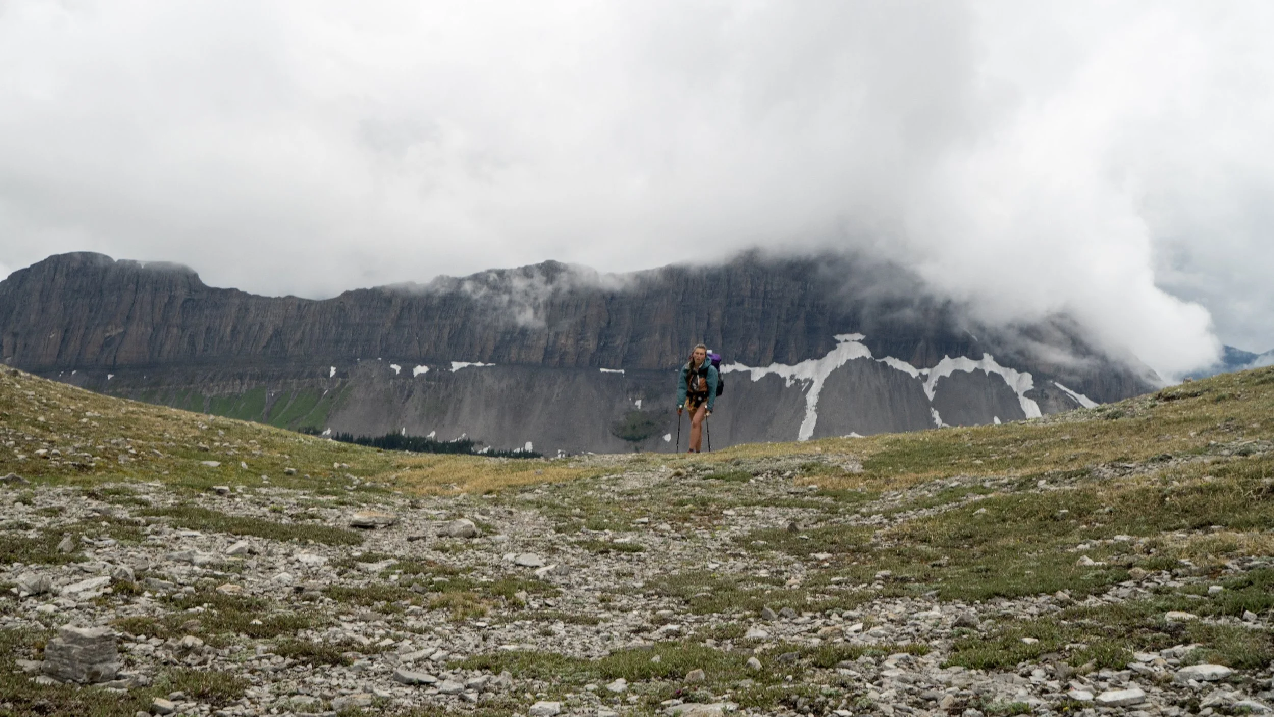
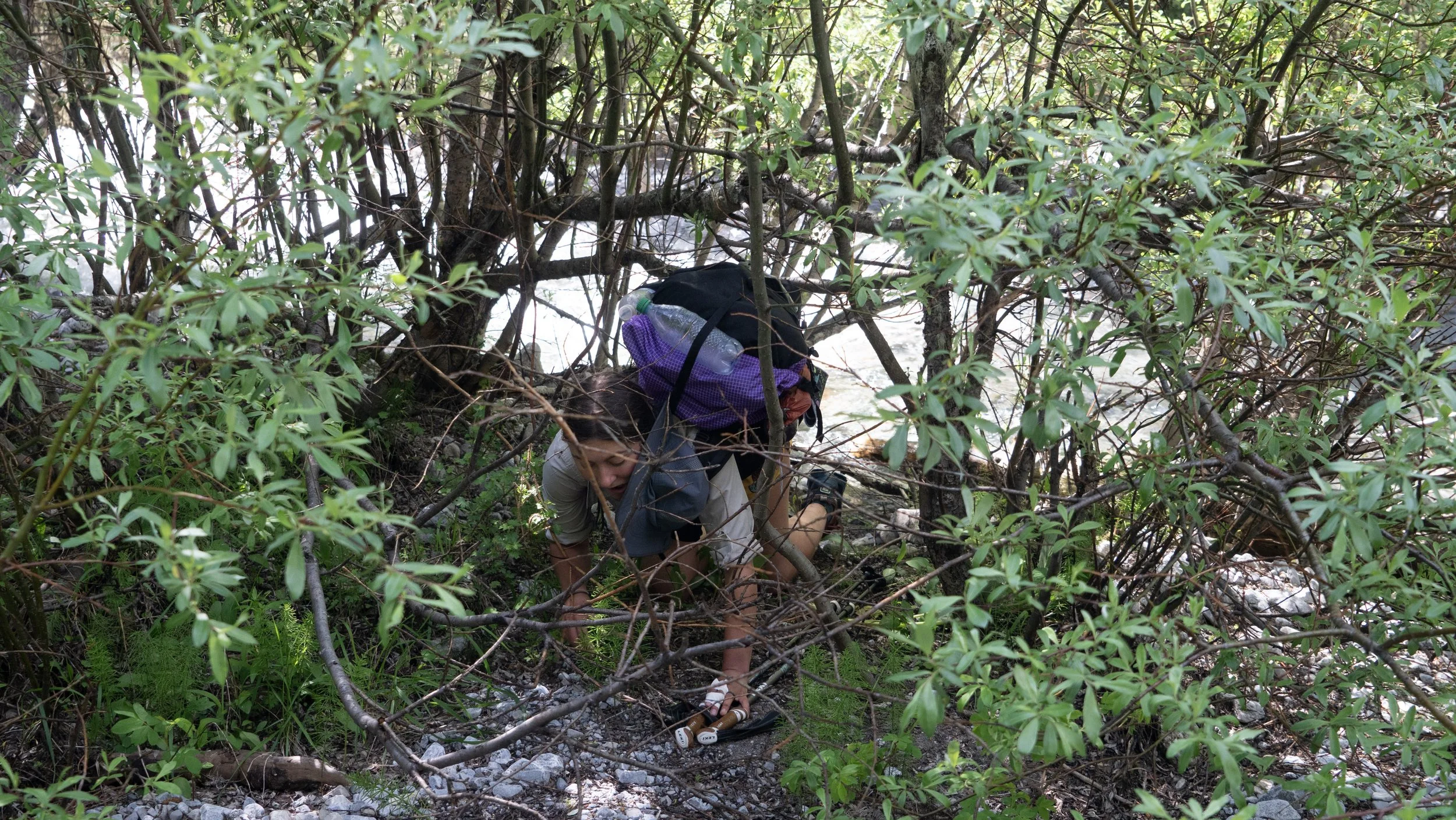
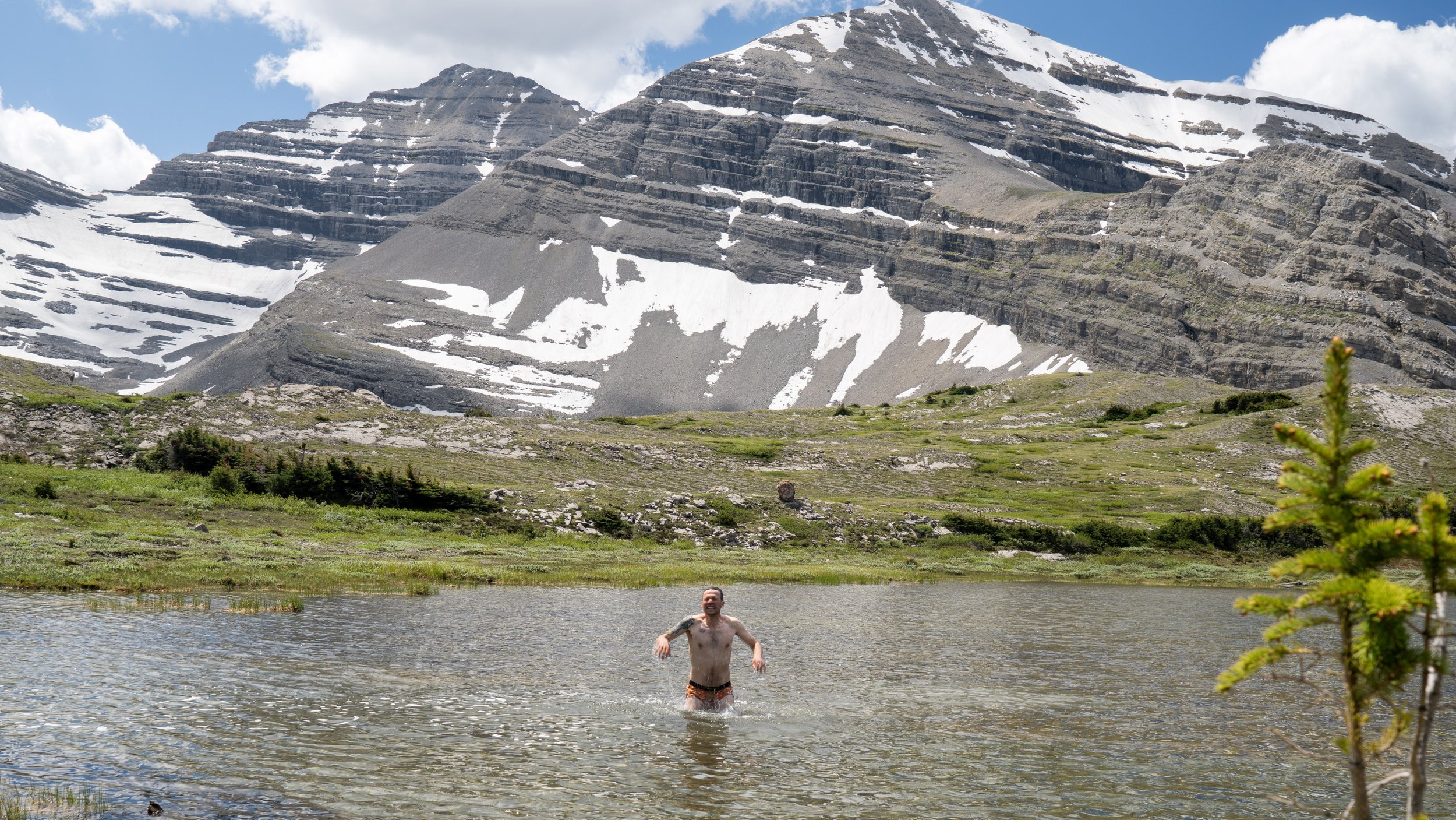
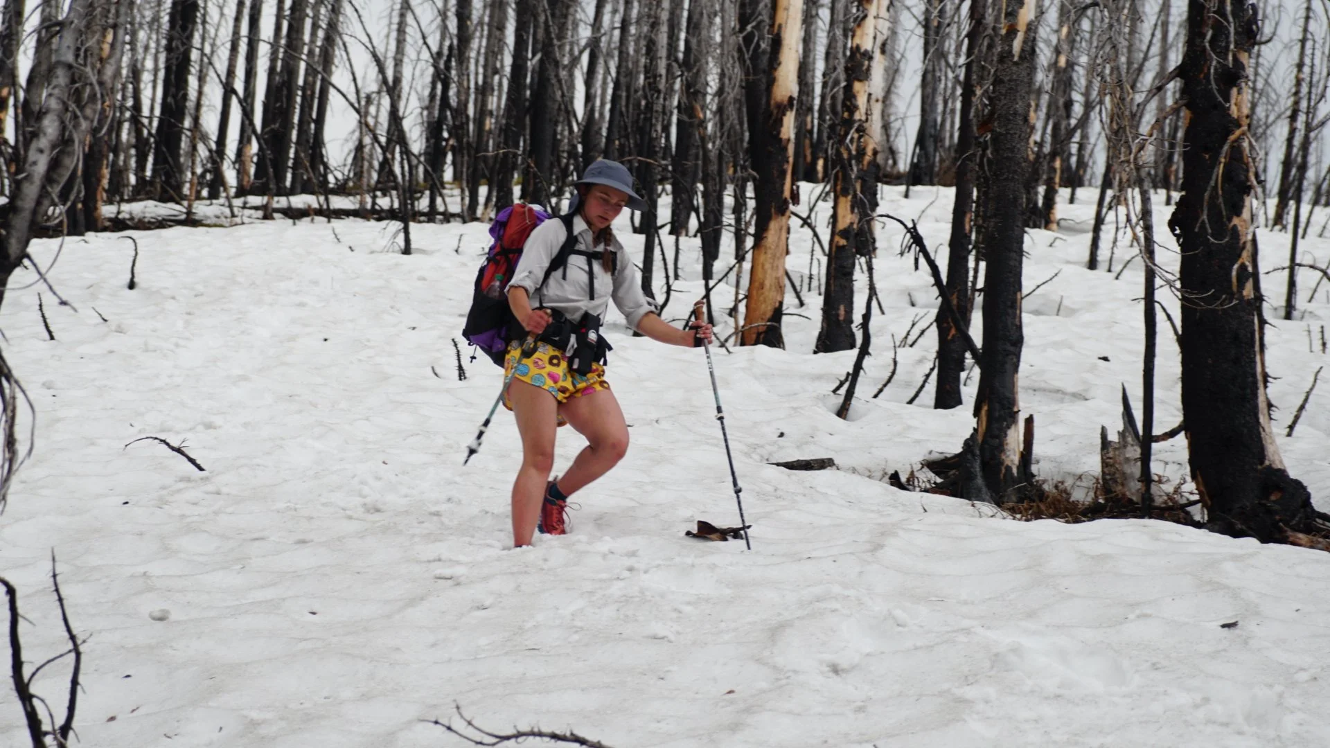
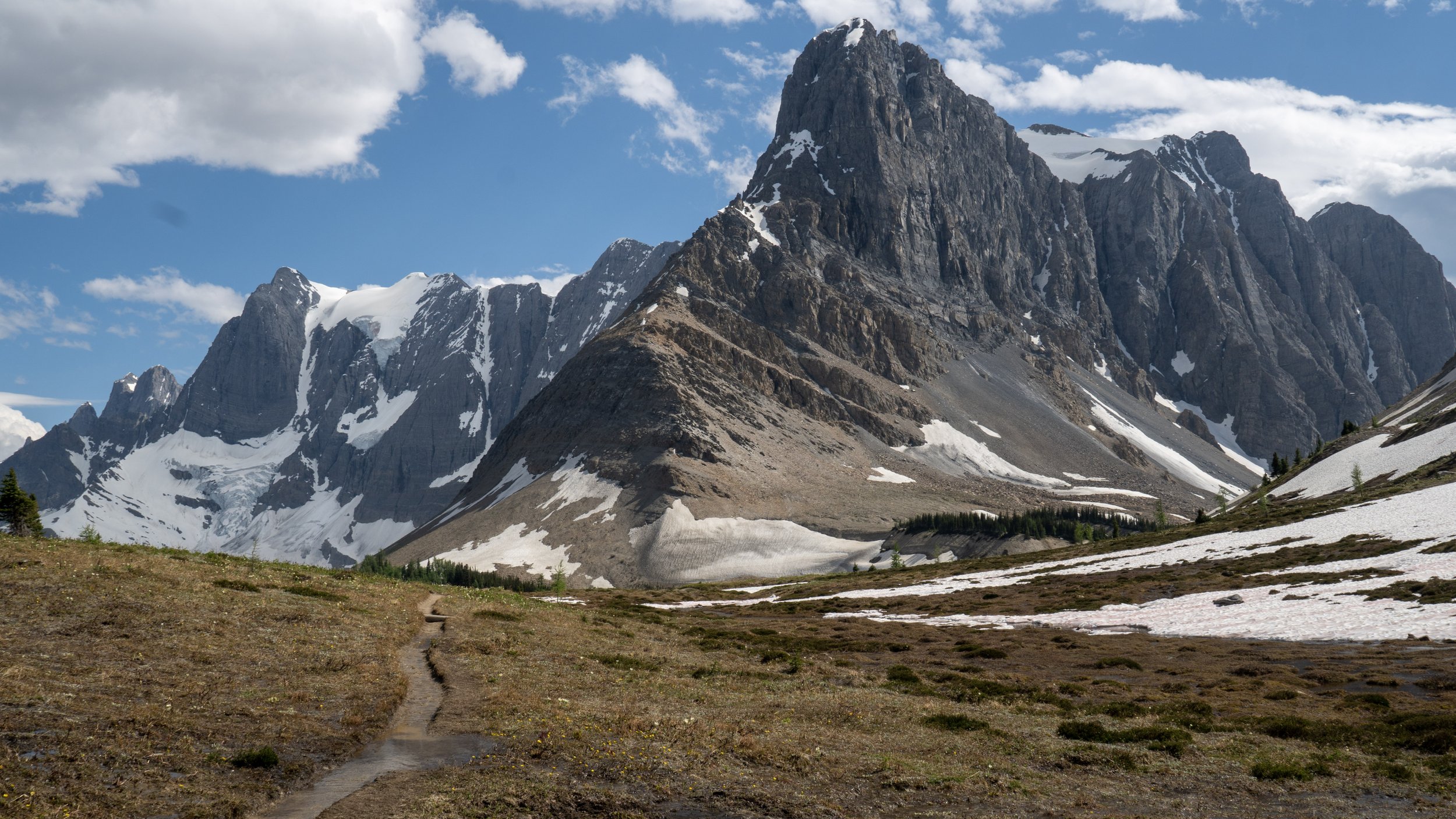
Halfway up the ascent we hit snow, section A all over again. It did slow our progress, but didn’t stop us. It was walking on familiar ground, the same we had been doing for the two weeks prior, by now we were masterfully dancing on the slush, pirouetting around fallen trees and vaulting others. We made it to Three Isles Lake, an alternate to the GDT main route, completely isolated amongst wicked peaks and glacial lakes. It wouldn’t be proper to leave such a place without a skinny dip and sun bath. 

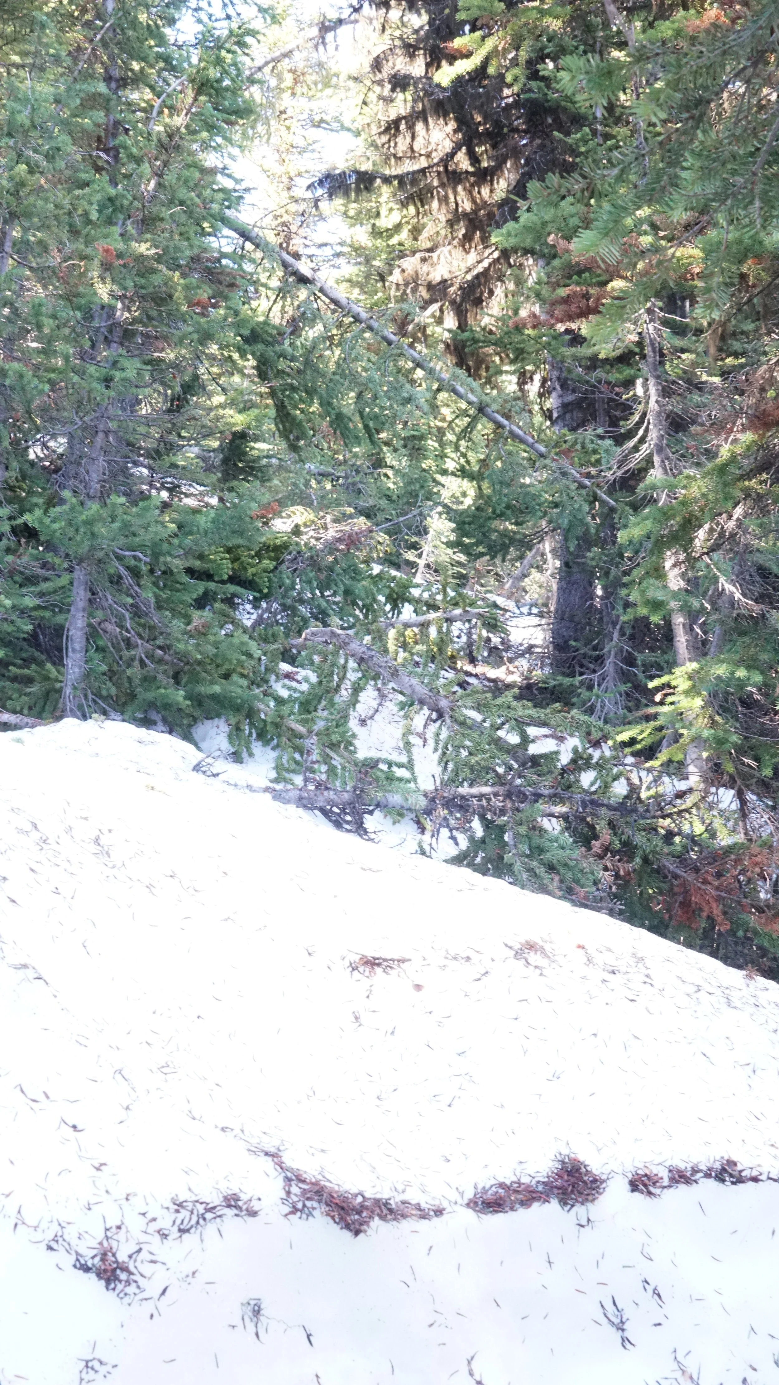
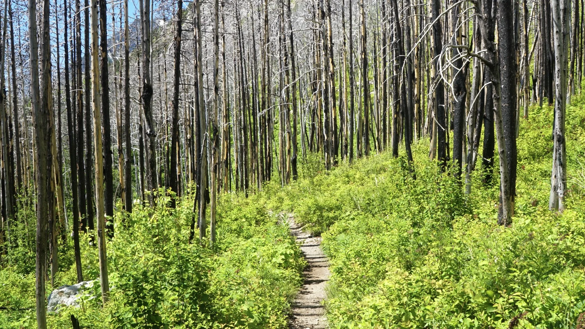
A typical scene from snowy, uncleared paths. Yes, that is “the trail”


Three Isles Lakes was gorgeous. Surrounded by wicked peaks on all sides that stacked stratified layers of rock formed in a wavy prehistoric acid trip. 


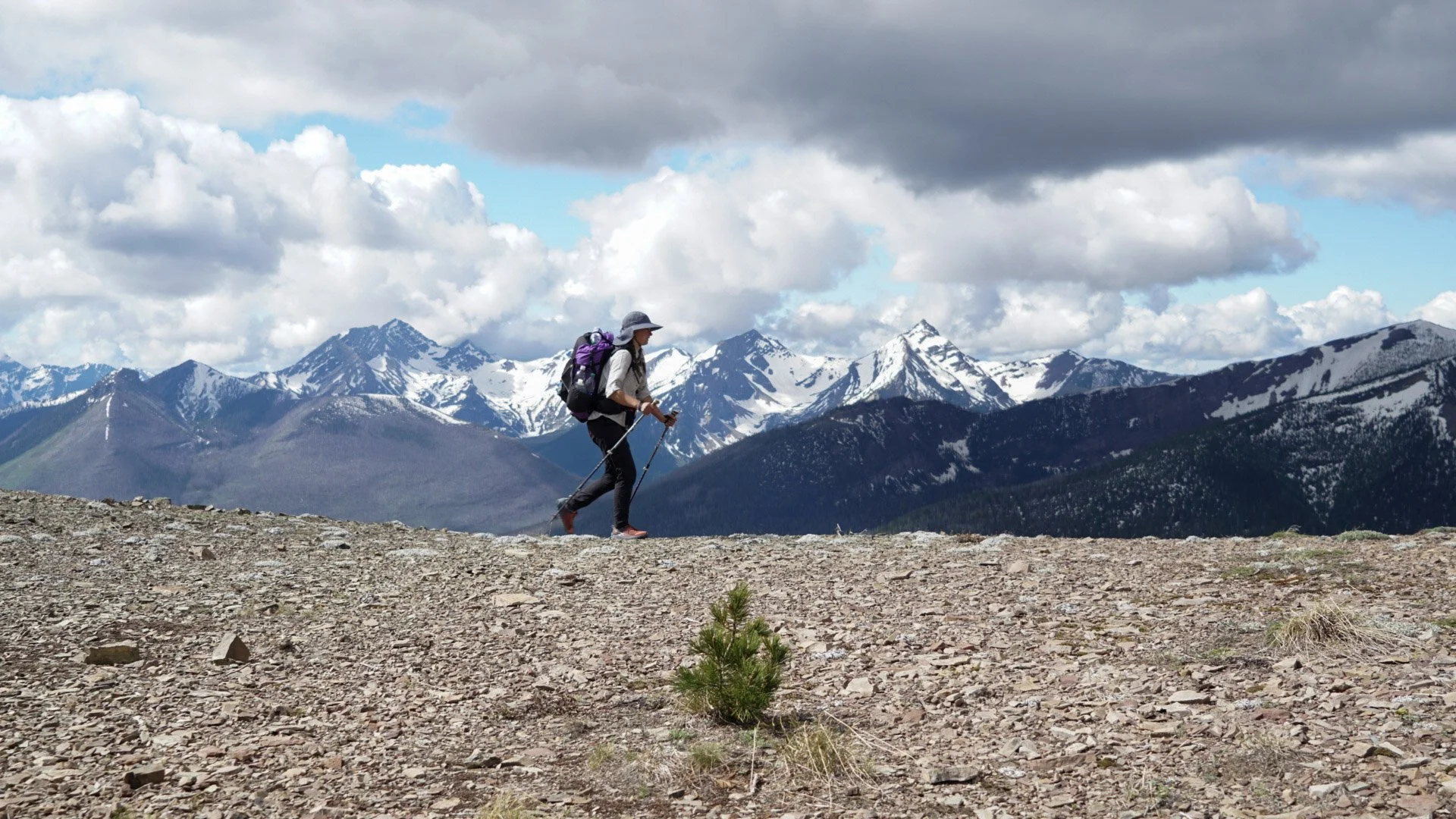
Beatty Lake was not far away, marking the final ascent of the day. Another stunning lake as it was, we had no time for a swim. It was already 5pm and we had many kilometers left to go before we could call it a day. We wound our way down the mountain following a trail of loose cobbles primarily used by four-legged critters. The mountains around us as we entered Height of the Rockies Provincial Park looked like sharks teeth, row after row of acute angled peaks bit into the blue sky. 


We were nearly to our campsite, one kilometer to go when we approached our first river crossing. It was a concern before we saw it. The thick bush would not allow a glimpse of the rumbling torrent, walking parallel to a sound created by no small river. We may have hit our luck's end. The trail would not turn, would not allow us a sight of the river, we continued up stream. Finally, a view. What we had heard was a series of cascading falls, where we stood presented a gray silty wash. Lucky. It was slightly braided and we chose to hop braid to braid of the stream so as to not cross the river in its entirety. 


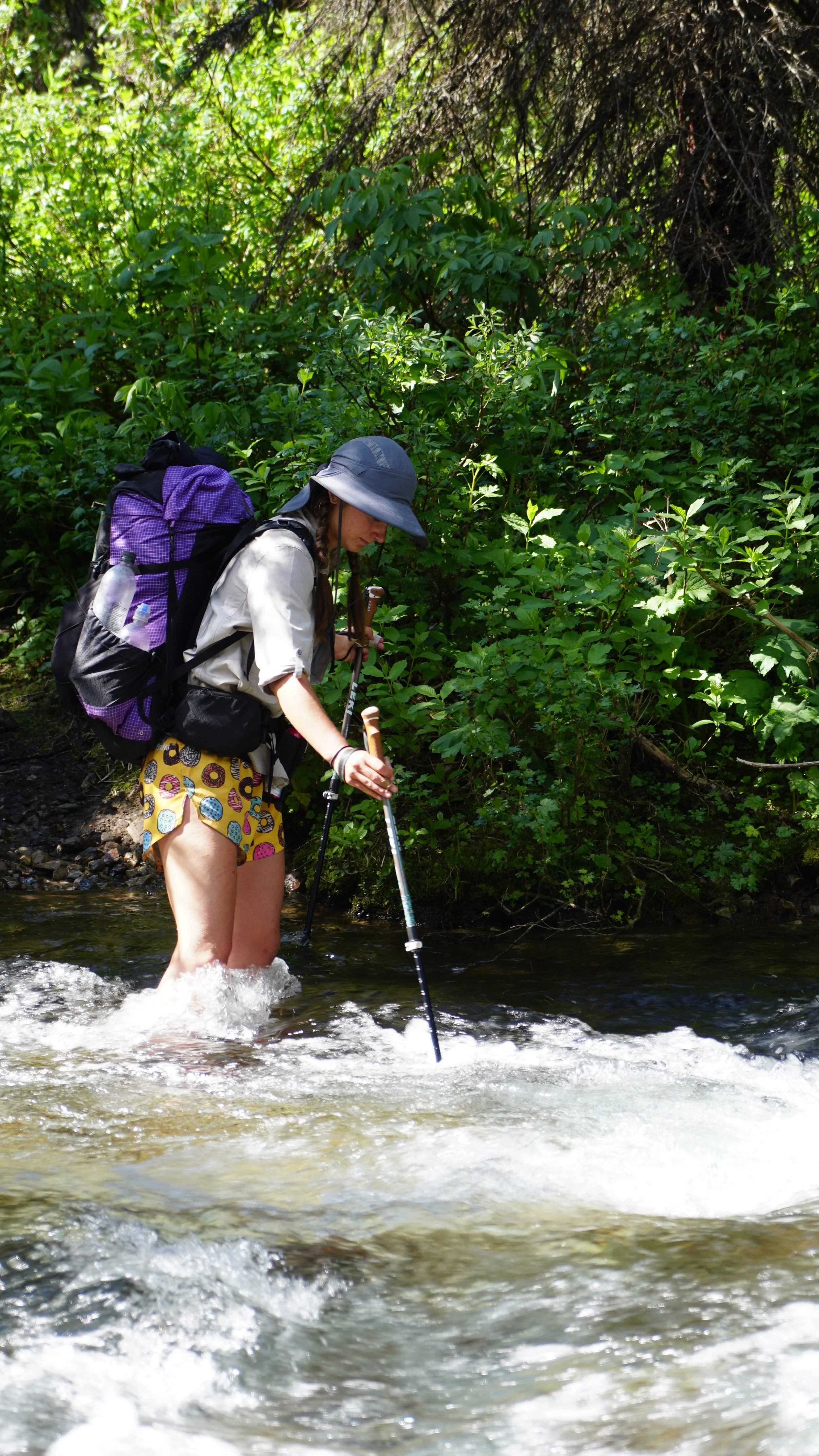
Less than one kilometer from camp and one more river, the Palliser River, then we can sleep. It was 9pm. Emerging from the bush to find a bigger river than before, we were screwed. Walking downstream, river to our left we looked for anywhere that might be crossable, no such luck. We were eventually cut off from our downstream search by a confluence with a smaller stream. Shit. We pulled out our map and GPS, checking we had come the right way. We did, but, we weren’t looking the right way. It was the smaller river that had cut off our downstream search that we needed to cross, a creek more than a river. Thank goodness, that would’ve been an awful 26km backtrack. Wading across and arriving in the meadow, we hastily set up camp, made dinner and went to sleep. It was 10:30.


July 12: Palliser River > Big Springs. 29km


Dare I say that summer is finally here, the warmth of the day was great. 


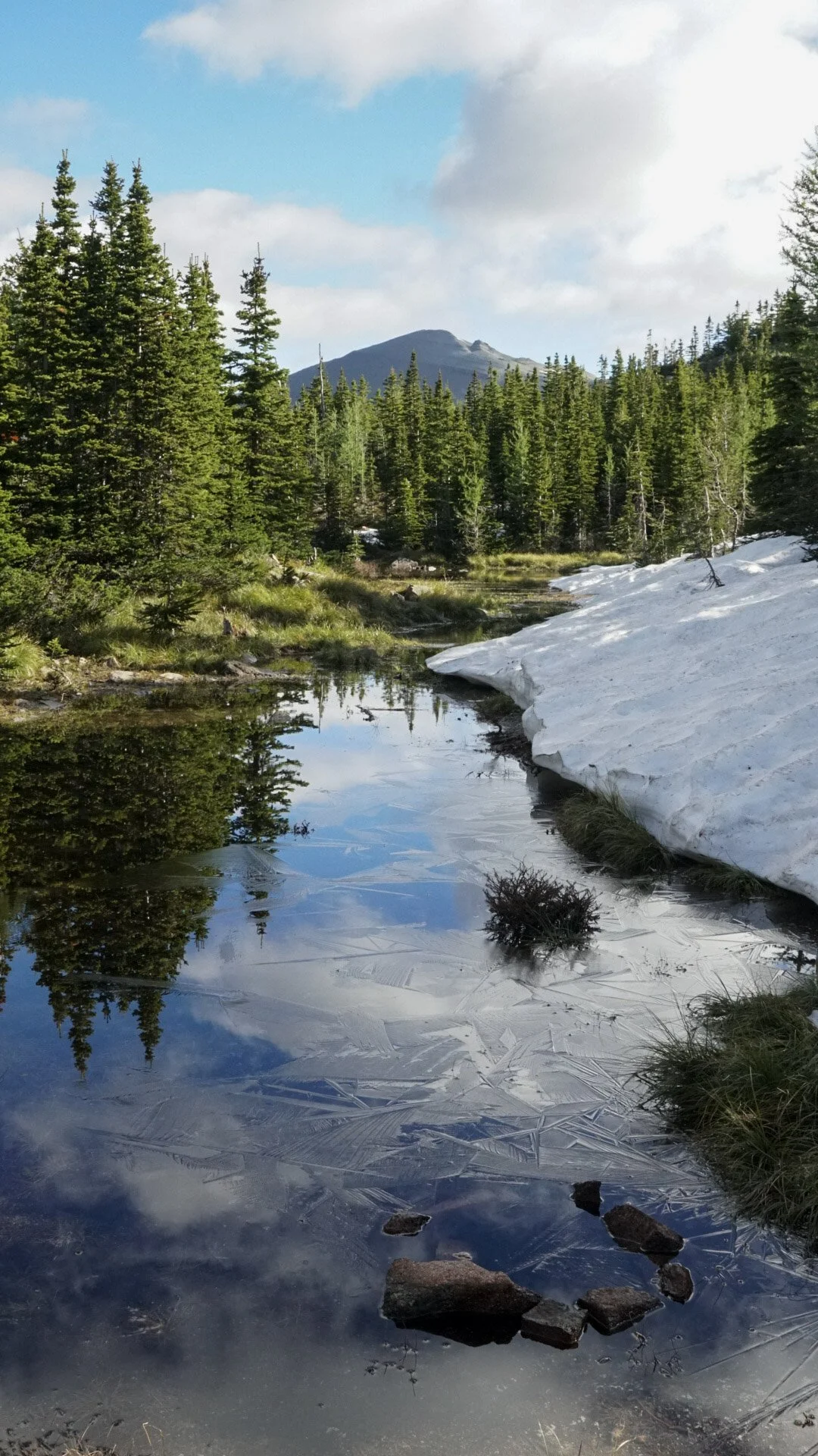
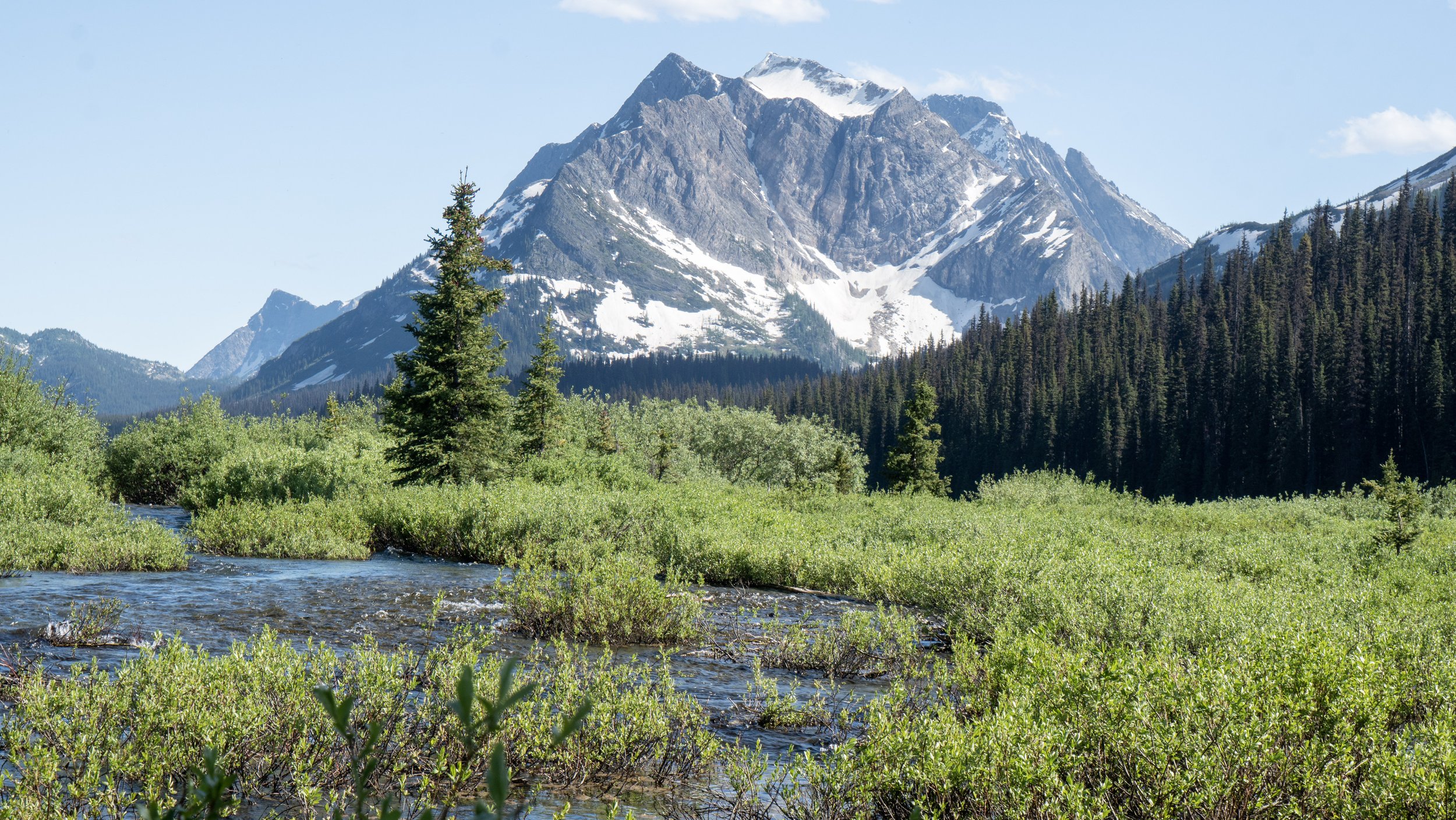
A 700 meter climb punctuated the beginning of our day, after that…flat. Yes indeed, it is rumored and confirmed by both map and GPS that the Spray Valley, the headwaters to the Spray River, is flat. Our climb up was hot, we had a late start to the day and felt the intense heat beating down as we climbed up the pass. The top was, as usual, snow bound. We gradually descended as we started through the headwaters of the Spray River, the valley warmed and snow disappeared, leaving a wetland in its absence. The 12 kilometers opened up a side of Banff National Park that I never knew existed, only imagining the tourist townsite as the main attraction. 


We walked in a long flat valley enclosed by stunning peaks. The shades of green varied all around us, from the grasses at our feet to the highest alpine in the transition to stone. 


The Spray River headwaters maneuvered in tightly coiled oxbows, so tight that one could fish both sides of the river from a single spot. We traveled along the valley, watching the river grow and develop as more streams joined into the collection of water bodies. 

Notable Features: Spray River headwaters, flat trail, grizzly country, wading, swimming


July 13: Big Springs > Porcupine. 29km


29km is just too long of a distance for a hike to be enjoyed for the entirety of the day. Same as yesterday, at 25km I was ready to be done. 


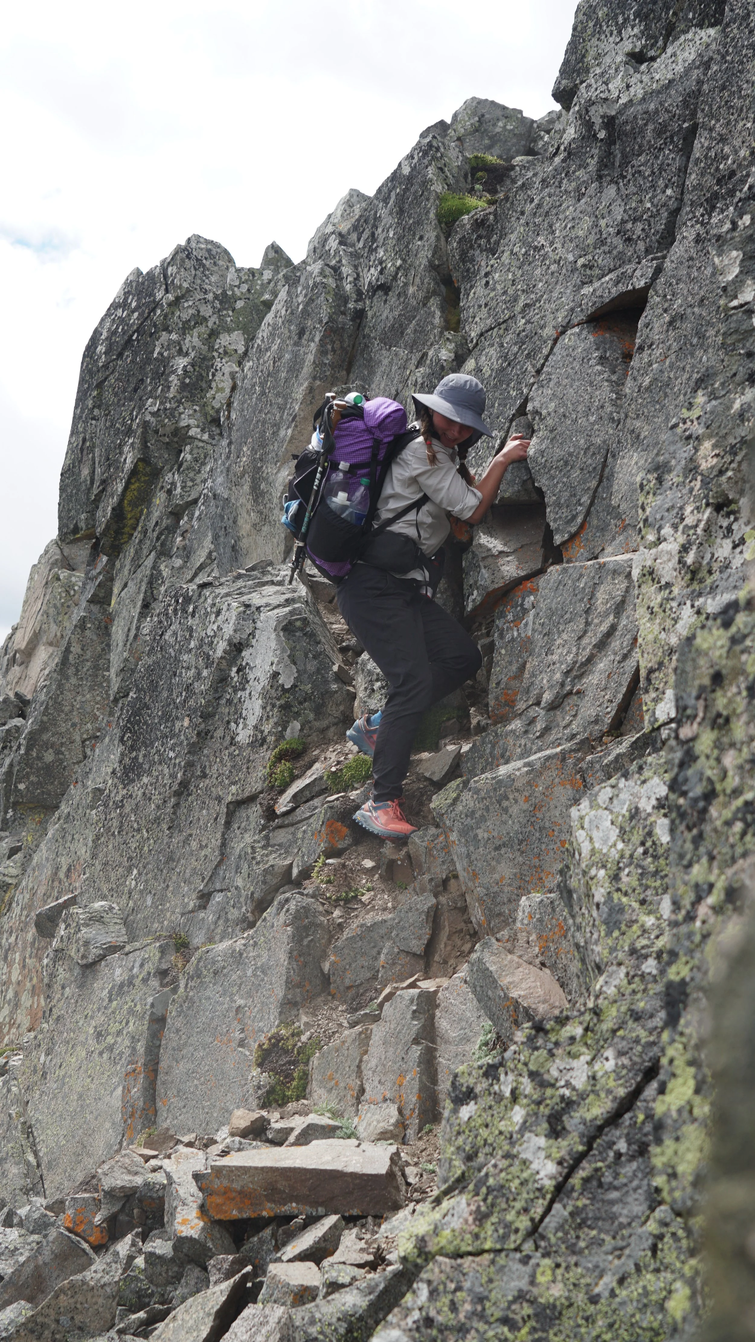
The parks bring out the people. We saw more people today than we had the previous two weeks combined. We pass by, catching whiffs of shampoo and laundry soaps, while they perhaps catch aromas of sweat, body odor and other bodily scents. Many people seem to like our shorts, maybe because they’re mostly all in pants and wishing for a crisp mountain breeze upon their upper thigh. Who knows. The parks also bring out trail crews, and they do a fine job of maintaining trails. With well taken care of trails we were able cruise along all day, not doubting our directions or bushwhack through thickets of foliage. In fact, the only time we were lost today was in a campsite, not a proud moment, but that was one confusing campsite map that did not clarify the river crossing. 


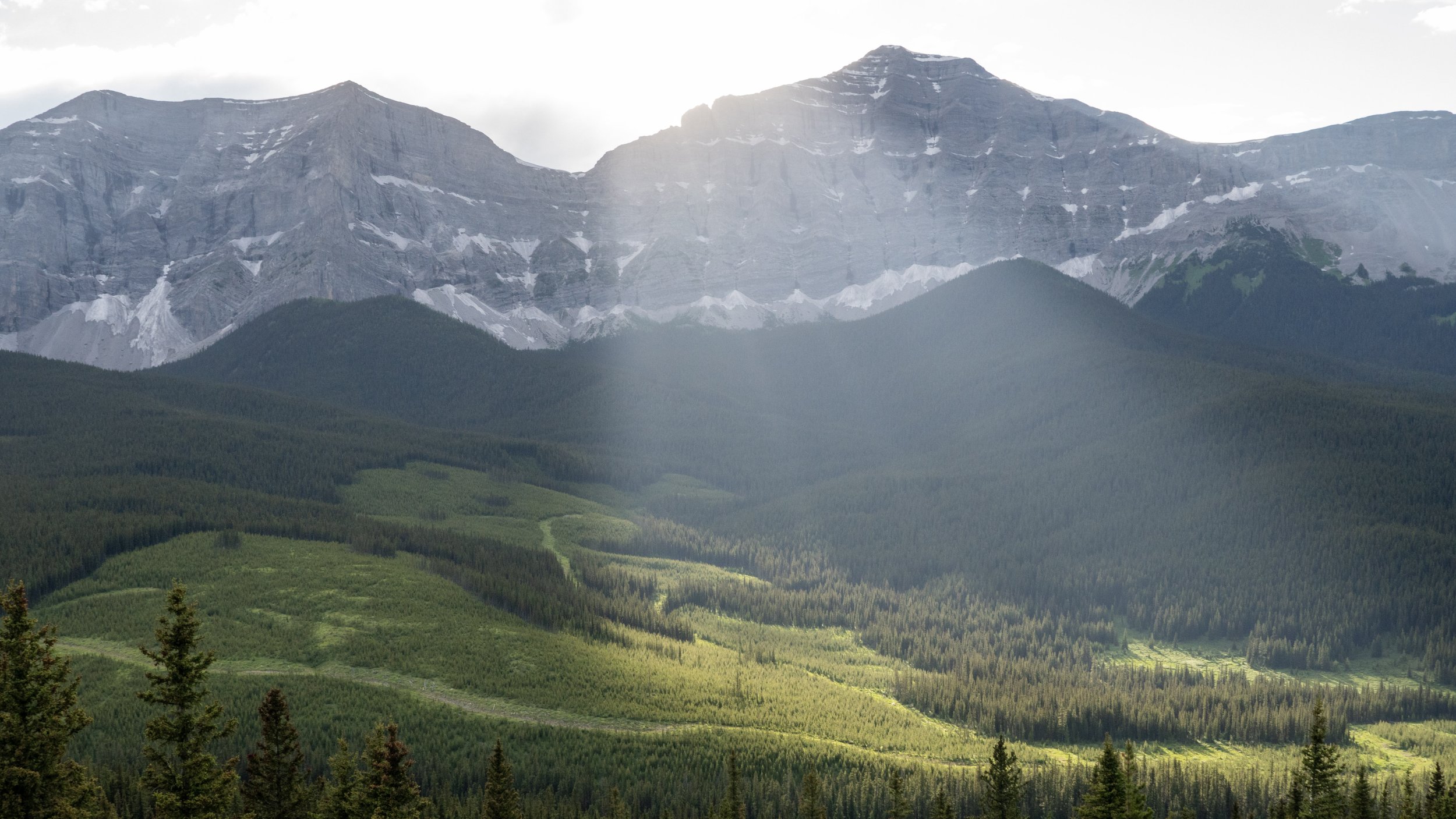
We crested Wonder Pass into Assiniboine Provincial Park, met with views from a mountain fantasy. Vibrant green larch forests coated the valley floor, prominent peaks dotted the skyline and a trail of perfect splendor brushed us along towards picturesque huts. No wonder it’s also a UNESCO World Heritage Site. We arrived at Assiniboine Lodge at the wrong time, also on the wrong day, for us to get beer. We took our time with lunch in front of the lodge, enjoying our lovely wraps and the view of Mt. Assiniboine. From behind us came an employee of the lodge and with all the kindness we could muster asked if there was any way she could get a couple beers for some dirty GDT hikers. The charm was on, after a nice chat and $20 we had two cans of cold beer. Oh yea, did that ever hit the spot. I’ve never been more willing to pay $20 for two cans of beer than at that moment, I doubt it will ever be surpassed. 

Mt. Assiniboine


Notable Features: cresting Wonder Pass, beer at lodge, dinner guests


July 14: Porcupine > Egypt Lake. 26km. 


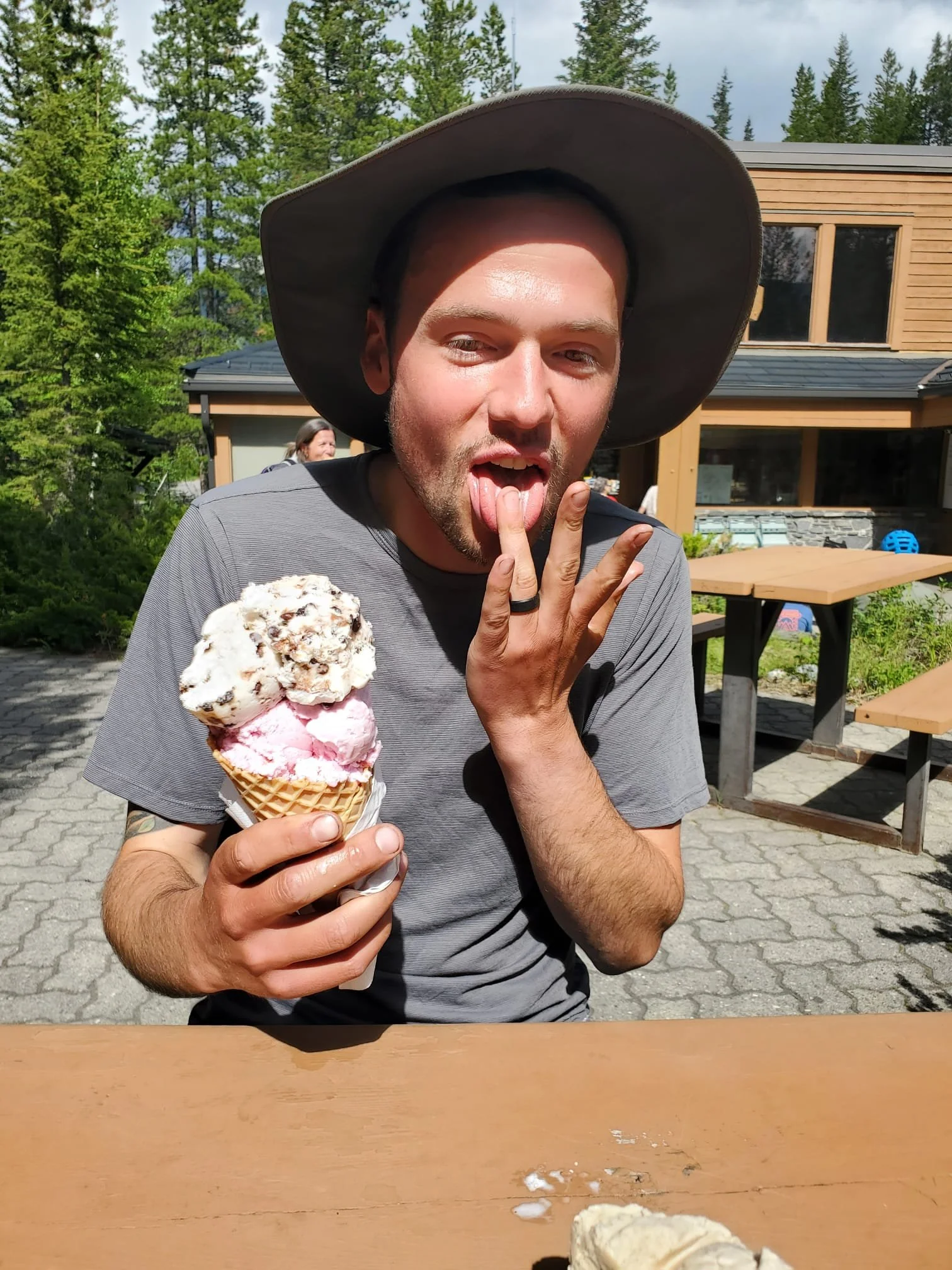
Today we walked right up to Sunshine Ski Resort outside of Banff townsite. The trails became even more neat and manicured as we approached the lifts. The Ski resort isn’t the GDT main route, but a small detour, and worth it. The gravel hill above the lift stations dawned sandwich boards for the Banff Smokehouse. We were sold. How lucky could we be to have beer the day before and another today?! 


Although a very poor representation of a smokehouse, nothing was smoked on the menu, they did have a glorious, fully loaded, massive, heaping cheesy plate of nachos. Topped with Chili.


We ate more than we could handle. Our ciders went down smooth and while waiting to digest our bloated uncomfortable meal, a woman walked over with half a pitcher of sangria, explaining that she and her husband couldn’t finish it, offering the concoction to us. Yes please. It took us three hours to leave the resort, still uncomfortably full, we needed to continue. Two passes, 13 km, stood between us and our sleep. 


Notable Features: Sunshine Village, Nachos, Assiniboine from Citadel Pass, Pooping, Larch Alpine Meadows


July 15: Egypt Lake > Numa Creek. 25 km. 


Today was going to be special, we were crossing highway 93, a highway we had driven several times. We neared home and a rest day. Today was also the day that Parks Canada had refunded our reservation because Floe Lake Trail was closed. We would have to take an alternate route, bypassing the astonishing scenery. 


The two passes, Whistling and Ball, posed little challenge to us, they were miniature relative to other passes behind us. Once atop Ball Pass, we were in Kootenay National Park. In order to make it to the highway, we would descend 950m over eight kilometers, a bit steeper than average descent (we like 100m per kilometer). Wolf tracks frequently appear in the trail, they use the trail here too. I hoped to see one. No such luck.


We once again needed to hitch a ride. Typically a hiker would cross the highway and continue to Floe Lake, but because it was closed we had to reach the next trail head, Numa Creek, eight kilometers away. It was not long before Kim and Kathy pulled up, a local couple who were headed to Calgary for a wedding. They were genuinely enthusiastic about our journey, asking question after question about our trip thus far. It was great to meet them. Thanks for the ride! 


The hike into Numa Creek was a “Chuting Gallery” of Avalanches and their debris. Several trail reroutes and seven avalanches from this winter held full size trees of the river, splintered and splayed like a pile of toothpicks. 

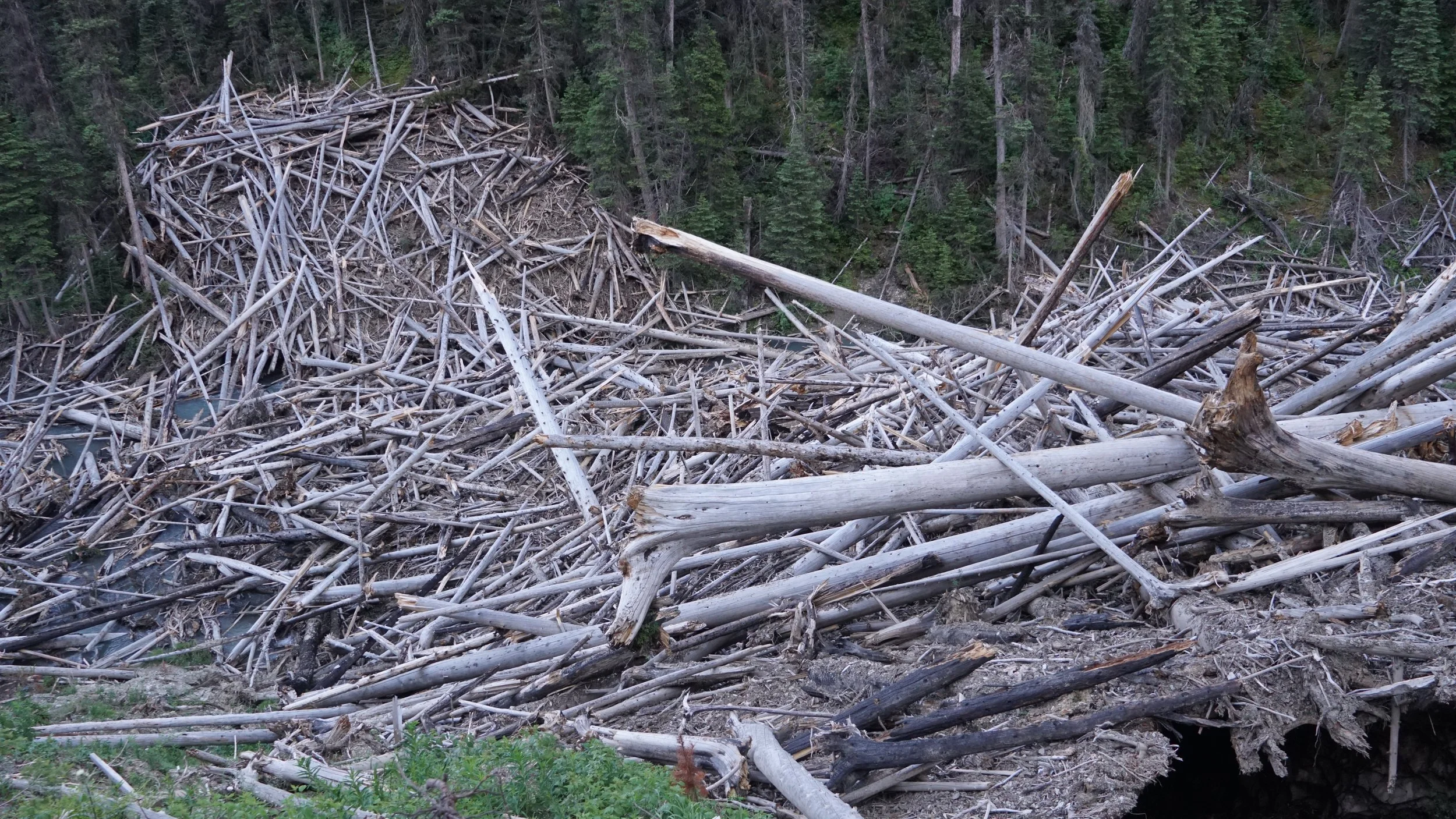
These logs are held in position by the snow. In the bottom right corner of the photo one can see the snow melting to form a cave.


Notable Features: Ball Pass, hitch hiking, Lil’ Bear, Descent to 93


July 16: Numa Creek > Helmet Falls. 20km


The “easy day” to Wolverine Pass turned into a longer moderate day ending at Helmet Falls. We arrived at Wolverine Pass around 4pm after a late 11am start to the day. Upon arrival we found that we still possessed the energy and drive to continue on another 10km to Helmet Falls, an unplanned site for the night. Who needs rest anyways? 


The rockwall was geologically phenomenal. A nearly unbroken wall spanning several kilometers north and south, as well as hundreds of meters high stood to our left all day. Glaciers hung in high nooks and hunkered low in shaded bowls, revealing themselves as we climbed higher on the adjacent slope. 


The sight was unforgettable. Pure, rugged Canadian Rockies. 


Nearing the site we could hear Helmet Falls roaring away, we could not see it yet, but knew it was far and large. Unlike any waterfall yet passed, this giant thunderous hydrological spectacle fell from the top of the wall, crashing on, not one, but two, shelves, thereby rerouting it’s fall and dispersing it into a large misty fan. 


Notable Features: Rock Wall, glaciers, 500km mark, Helmet Falls, Sneaky Camping. 


July 17: Helmet Falls > McArthur Creek. 14km

We were awake at 6am after waking to an alarm, wanting to leave nice and early. We skipped breakfast and went straight to the trail, eating several granola bars instead. Today was short and more excitingly, we were meeting our friends at McArthur Creek where we would all walk out together the following day. 


The day flew by. It was 11:45am when we arrived. Hell Yea. Now it was time for some proper rest, nothing to do but wait. We filled up our water, and went to our tent where two hours of napping took us to early afternoon. A bit of yoga with glacial views followed. It was a great afternoon. Our friends Jess, Melanie, Paulina, and River the dog arrived around 4pm. They brought so much good food, enough to share. We got into a game of cards before bed, it felt nice to change up the pre-bed activity which was either hiking or eating. 


Notable Features: Short day, big nap, friends!, cards


July 18: McArthur Creek > Ottertail Parking. 14km

An old fire road was our trail today, gentle on the knees and on the grade. We were able to finish our hike out by 2pm, in only 45 minutes and we would be in OUR own house, with a shower, food, and a bed. Our first shower in 14 days and first proper laundry in 22. It is more than convenient to live next to the trail you are hiking! We look forward to two complete rest days, good food, stretching, and sleep. 

Section B: Coleman, AB to Peter Lougheed Provincial Park. 196km

This post can also be found at Thetrek.co

Our rest day, or Zero day as it is commonly called, was sufficient. We dined well, imbibed and did some ole’ fashion laundry. There was no laundry facility at our hotel, so doing the best we could, we filled the tub, tossed in some detergent tabs and started stomping around in wardrobe soup. Also, lacking a proper dryer, we strung our rope around the room, creating an impromptu clothes line that split the room in two. Ahhh yes, the luxuries of living. The rain fell while we huddled inside, the power went out several times. Simply glad to be dry and in a room. 


July 4th: Coleman, AB > Window Mountain Lake. 27km


Departing that dry and warm room was a sad farewell, clouds hid the mountains with a high chance of rain in the afternoon. On we go. Leaving Coleman is a walk along the highway shoulder, up through a quaint neighborhood proudly flying their “I <3 Crowsnest Coal” and “Fuck Trudeau” flags above their yards. The pavement transitions to gravel, winding along forested roads. Several RVs pass us, coming from our destination, in tow with all the fuel burning toys one could adore on muddy backroads. Pulling up alongside us is a yellow Ford explorer, glancing at one another we think “A Ride?”. It’s a local who has lived up the road all his life, he warns us with concern that there have been several grizzlies spotted in the area recently. “Cool!” I say, wanting to see a grizzly myself. Looking at me sternly with a majority of his teeth, he counters “Not Cool. You best be careful. Hope ye got bear spray.” We point to our belts. “Good”. The aged man goes on about a grizzly mother raising one black and one brown cub “If you see those three, I hope you get a picture. You’ll see nothin’ like it again….” Pausing in thought, then “Take care now.” Off he drives. 


We have walked 12km on forest roads now, packs loaded down with seven days of food, shoulders aching while UTV after UTV zooms by carrying passengers in neon slickers searching for silty mud and opaque puddles. We reached the trail, but not after making a couple of wrong turns and walking a kilometer in the wrong direction, making it a total of two kilometers back to the correct path. Mohammed, a fellow GDTer joins us, but not for long, he is on day one of his GDT journey, having skipped section A, his pace far outweighs ours. 


The single track trail is a relief, the sound of cylinders is muffled by the forest. At last, we are back on a hiking trail. Through clear cuts and along seismic lines we go, walking under the ever darkening sky. 


The official GDT route has changed since 2017, the year our maps were last updated, and now is rerouted to include the High Rock Trail (HRT) which takes hikers above treeline to the base of a rock wall, heading north. Misty clouds soon swallowed the vistas that the HRT is known for. With 10 kilometers to our campsite, the rain was upon us. High hopes encouraged us to stay out of our rain gear “it’s a light sprinkle” “it’s just a bit misty, we’re fine” “dress like the weather you want it to be!” Oh my. Silly hikers. 

Hanging on to our warm weather mentality.


It was about 5pm when we climbed onto the HRT, the mist was setting in, and, within the hour, deluge.

Misty drops opted for heavier precipitation. Now we listened, putting our rain jacket and pants over damp clothes. Visibility dropped to 50 meters, in the cloud we hiked as the wind and rain bullied us along the scenic trail. The stomach of the sky deity was hungry, rumbling from the skies, at first from afar, but closing in. Streams ran where our trail should be, mud caked our saturated feet as we slipped along. The sky cracked, illuminating the rock wall to our left, a monolith spanning all visible sight. We had no choice but to continue walking, there was no out. Solange’s hip began to twinge with pain, it commonly happens during changes in weather, slowing us down, prolonging our exposure to the storm. I’m cold. My gloves are wet, my fingers are losing feeling. I grow frustrated. “Can you walk any faster?!” I quipped. “No” Solange replies. Knowing that there is no option but to embrace the situation, we gradually walk. Somewhere amongst the rain, my mind and the cold we have gone off trail. I don’t want to be here. Soaked through and freezing. I know Solange is too. Determining the correct way to the trail we begin the off trail sidehill and approach the trial from above, between us is a steep grassy slope. I begin to tread carefully down, but that won’t do. I slip on the grass, begin to slide, hit a fallen log, tumble, and land on my ass in the middle of the trail, water bottles strewn about. I grumble, slowly raising to my feet, leaving some pride in the mud. Solange opts for a smarter alternative, sitting down and using the wet grass as a slide down to the trail. 

Mohammed and Solange topping the muddy hill.


Enduring several more hours of heavy rain, the clouds have been wrung out and cease their falling misery. Not far from camp now, our shoes squish with each step. A lake at last. The other GDTers have already set up tents and are eating dinner when we arrive at 9:45pm. Their spirits are not as waterlogged as ours. It wasn’t until we began to set up camp that I realized, apparently Solange had known, that our bags were not waterproof. We erect our wet tent, and assemble our sleeping arrangement. My wet sleeping bag slides from the stuff sack. Solange uses a dry bag. The day will not end. 


Our saving grace is our food. We did not spend hundreds of hours on food preparation to create unsatisfactory meals. Spicy Ramen in broth was the sole option to warm our dampened spirits. We dined with thanks, the rain had stopped. Finishing our meals, I volunteered to place our food in the bear lockers which sat nicely in bitter cold shin deep water. Wading in slowly, I made it 15 meters to the lockers. First Locker, full. So was the second. A random locker it is then. Whether through pity or praise, the gods smiled down on us as I opened the bear locker. It was not empty. Staring back at me from the center of the locker sat a glass bottle, nearly full, of Elijah Craig small batch bourbon. The tonic for saturated souls, a warming jacket of the frozen. I returned to the shore with the treasure, toasting to completing a day of misery, we took a swig. The bourbon warmed us from tongue to tummy, easing our pain, a lullaby for sleep.

Notable Features: wrong turns, rain-rain-rain, wet pack, whiskey!, swollen knee. 


July 5th Window Mountain Lake > Atlas Road / Dutch Creek Junction. 25km. 


We awoke to a blue sky. Thank goodness. Today would be better. A late start and we started hiking at 10:40, after yesterday's beating, we allowed ourselves the comfort of sleeping in and taking things slow. My knee was beginning to be more troublesome, not so much on the up or flat, but the down. How had I messed it up? I was uncertain. Section B turned out to be the antithesis of flat, an elevation profile reveals an erratic irregular heartbeat that the finest pacemaker couldn’t settle. In other words, my knee would be put to the test. Today 1200 meters up, 1600 meters down. The summits clung to their snowy caps, each pulled down over their ears, meaning we had bottomless trudging through slippery snow. My knee began to give me grief and occupied a place in the corner of my mind. The twinge grew more intense during the day seeding doubts of a successful trip. It’s easy to get caught up in a negative thought cycle. My mind swirled, with each consecutive slip of the feet, my knee’s seeds grew. Coming down the second hill, or perhaps third, of the day I went to cross a snow bridge over a creek, the water was clearly audible under the snow. The trail was covered, but footprints guided us along, bringing us to this bridge and further, I crossed. My last step to the other side and I fell through, one leg on the bridge, one on the other side. I performed my one and only ever gymnastics move, a near splits in unison with a faceplant and soaked foot. Like yesterday, I groaned as I crawled up. This damn trail is beating the shit out of me. That was enough, I resorted to an advil, I didn’t want the pain anymore. 


A large descent led us to a snowless, replanted clearcut. We felt like giants towering above the cohort of trees, standing about 1.5 meters tall. A trail junction with a logging road coerced us into stopping for lunch before our next climb. I was feeling pretty beat up after the last 36 hours, was I going to make the 900 kilometers of hiking? At lunch we pored over our maps. At this point we had more or less given up map and compass navigation, the trail was hard enough as it is and we already hiked all day, we didn’t need more complications. Lunch was over, our pepperoni stick and hummus wrap with a sprinkle of goldfish hit the spot. 


Standing up and turning around, I froze. “Guys. Guys!” I whispered, “Look”. There roaming among the young trees was a grizzly bear. We all stopped and watched as it carried on. Had it seen us? Does it know we are here?! I was sure that it knew exactly where we were, how could it not? We were by no means quiet while eating lunch. My bear tour self emerged, ensuring that everyone stayed quiet and still. The bear was going to cross the road right in front of us and sure as hell, it did. 40 meters away the magnificent bear walked into the road, looked over at us and continued on, not changing its gait, not missing a stride, looking at all of us dead on. 


I was revitalized, my moral compass upended, this is why I am out here. All the suffering, rain, and cold was worth it for those few seconds. To be in the WILD, to walk with bears, to be at the mercy of the natural world. Holding reverence for the wild, we challenged ourselves in its arena, not to win or conquer, but to test ourselves, to prove that WE are able. 


It lifted my spirits immensely. In the Wilderness, no barrier separating, to look upon a grizzly while it looks at you. Amazing.


Notable Features: swollen knee, advil, grizzly, fell through snow bridge, forests. 


July 6: Atlas Road / Dutch Creek Junction > Hidden Creek. 25km.


Today was emotionally hard. I doubted my ability due to my knee, the rain was incessant (It’s July!!!) and eventually got cold. 


Today we climbed Tornado Pass and descended the other side, that is about it. A long up paired with its partner, long down. We crossed a stream several times while hiking up, eventually coming to snow within the old forest. Laid in the snow were two sets of wolf tracks, clear as day, they could’ve been from this morning. One of them had paws that were as large as Solange’s hand! 


Rising above the trees, the pass became clear. We needed to cross two residual avalanche paths before arriving at the base of the steep climb. The avalanche paths, although perhaps crossable, were too risky to be crossed. Without an ice axe, one slip would send us sliding hundreds of feet. A risk not worth the reward. We scrambled up alongside the snow on loose cobbles and stone, shifting under each step, occasionally sending a rock down towards Solange. We clambered on offset from then on. More than halfway up the rocks we looked down to realize our mistake, if we had gone below the snow, rather than above, we could be walking on a trail and not this loose sharp collection of cobbles. No turning back now. We find that once above the snow we needed to follow a goat trail along the tops of abrupt drops. I wouldn’t call these cliffs exactly, for they were four or so meters tall, but the trails were thin on the loose rock. No slipping here. Carefully stepping along, I slid once and jumped onto my other foot. Heart racing, I teetered across to a safe resting place. Solange’s turn. She does the same, more methodical, crossing with grace. 

Nearing the final climb of Tornado Pass


We scrambled to the top, once again climbing on all fours. Fortunately the aspect of the pass was south facing and there was no snow. Every pass has two sides, this one had a north face, and cresting the top I yell with excitement “Whoooooo!!! We did it!” In a few more steps, I shout again “Noooooo!! Why?! Aagghhhh” A cornice settled nicely covered the shoulder of the slope. When Solange arrives, she is also not impressed with the cornice. Fortunately it doesn’t cover the entire shoulder of the slope and we walk up and around it. 

Solange completing Tornado Pass ascent, tired.


The descent begins. More mist, this time coming up from the valley. Rain starts as we descend. Nearly like day one all over. Residual snow covers the bottom third of our descent, seeing someone else had glissaded, we chose to as well. The 50 meter glissade brought unconquerable smiles to our wet faces. Just the fun we needed. 


I need to remember that this is what I want to do, where I want to be. Although it hurts, I need to improve my gratitude while out here. 


Notable Features: wolf prints, glissade, tornado pass, avy debris. 


July 7: Hidden Creek > Memory Lake. 24km. 


Another day filled with ups and downs. Section B is more physically demanding than section A, better trail conditions, but more elevation change. Today my knees gave me more grief than ever. I must’ve been overcompensating with my left leg and now the interior quad muscle hurts more than I ever knew a muscle could hurt. I limp along, no longer maintaining a regular gait. Other than my knees, the day was amazing. Alpine meadows, lush forests, and gushing streams. The weather was splendid and could not have been better. 


We took a leisurely lunch in an open pasture by a creek, ensuring to get in a good bath before continuing. Sunny Alpine kilometers were the first of the hike. We didn’t make it to our intended camp. Both too banged up and exhausted to carry on. I winced with each step, the pain detracting from the day. We went to bed early, setting an alarm for 6am to make up for the lost kilometers that we were unable to complete today. 

Notable Features: giant cirques, alpine meadows, warm, lots of elevation. 

July 8: Memory Lake > Etherington Creek. 30km.


To our west lay a wall of monoliths, cirques and sheer 1000’ tall walls. 


It was our biggest day yet, covering 30 kilometers. The elevation let up and we felt in better shape than the day prior. We walked along ridges that parallel landscapes that define the Canadian Rockies. Huge monoliths, cirques and cliffs reaching upwards of several hundred meters. It was amazing to reflect on where we had come, using peaks as landmarks and discerning our route. “We went over that hill, down the valley, up to the base of that cliff…” Our directions were all relative to landscape features now, no longer the names of streets and towns. Our perception of travel and direction was tuning to the land. Most of the day was spent on ridges with views of the impressive geology. 


My leg became worse as the day went on, eventually bending it at all became a pain. At lunch I was able to massage it for a period of time, eventually loosening the muscle and allowing me to walk at a more regular speed. Lunch was taken near Lost Creek Camp, a seasonal hunting camp, which was festooned with relics of the field. Lasso’s, ropes, chairs, axes, fire pit and grill, skulls and moose paddles. It was fun to poke around and admire a collection of objects in the middle of the woods. 

Some of the ornaments at Lost Creek Camp


We would have liked to stay at the camp, but our lack of distance traveled didn’t agree with our schedule. We carried on. I’ll be massaging my legs three times per day now to keep me walking at a semi-normal speed. We’re nearly done with section B. A much needed rest day is coming up. 

The day was so long that it all blends together, today was yesterday, yesterday today.

Notable Features: Lynx, dry feet, alpine meadows, ridge views, larches. 


July 9th: Etherington Creek > Weary Creek. 29km.


Awaking to the sounds of birds and a woodpecker hammering at the tree we slept under, we felt well rested. Something about coming to the end of section B had put a pep in our step and had us feeling rejuvenated or perhaps excited to have a rest day. Although today was another long day, 29km, there is only one, yes ONE, pass to climb before we finish off section B! My legs felt good in the morning, Solange felt good. Our energy had us pushing hard for the end. 


The dry single log crossing

Awaking to dry feet was also special, a rarity with snow and stream crossings. So when we came to a stream crossing where a bridge had deteriorated to a single elevated log, I chose to take the gamble, either make it across dry or fall off and get wet. I continued to enjoy my dry shoes, while Solange waded across the creek and crawled through the thicket of willows. Up we went, the top of Fording River Pass in our sights.

The wet willow crossing


By 1pm we were atop the gusty pass, looking back into Alberta and ahead to BC. Like a cherry atop a pie, a shallow lake crowned the pass. We jumped in for a nice alpine dip in the little water body celebrating the summit of our only elevation of the day. 


Although we were heading down the rest of the day, it didn’t mean things would get easier. The bottom of the pass had a hydrological maze awaiting. Trails washed out, mudslides and rocky flood plains made it near impossible to stay on route, occasionally making a foray up the steep banks only to learn that the game trail petered out after a short distance. All we knew is that we needed to make it downstream, crossing the knee to thigh deep river several times. This was our biggest river crossing yet, one that required us to find a proper crossing where the water wasn’t too fast or current too strong. Scouring up and down the bank we were able to find our five crossings, although we later learned that only two crossings were needed. 


At Aldridge Creek campsite we took a break, recovering after the river toyed with us. There was a spot of cell service, learning that one of our reservations for the next section had been refunded due to the trail being closed. A wrench in the plans. That was neither here nor there, well, it was there, but we’ll deal with that later. 


The Parks Service has closed Floe Lake due to inadequate, severe, conditions…Another detour, good thing we’re well versed. 


We scooted the last 8km down the forest service road to Weary Creek (aptly named) where we would camp. Our Zero day relied on it being a busy road and we would hitch the 30km to Kananaskis where we would rest for the day. During our walk down the 8km of road we saw three trucks on the road, definitely a busy road, fantastic. 

Notable Features: alpine swimming, end of B, wonderful day, happy, river crossings.


July 10: Weary Creek > Mt. Sarrail. 32km


A Zero day?! No Way! 

The previous night, Saturday, we saw three trucks driving around. One truck passed us at 8:30 this morning just before we were to set off. Turns out the road is not so busy on Sunday morning. With no vehicles coming or going, we had no choice but to begin our walk. Rather than rest all day and hitch the “busy” road to our next site, we had to start walking. The road was mildly entertaining, we saw plenty of ground squirrels, a few GDT southbound bikers, but besides that we were walking the road. Boredom brings out the loopy personality that is within all of us, singing songs with no coherent meaning, entertaining ideas that are inconceivable in a normal mental state, and using the middle of the road as your music festival dancing grounds. It also turns out that when you want to hear tires tearing down a gravel road, other sounds begin to sound the same, such as creeks and wind through the trees. We were let down a lot. Three hours and 10km into our walk, I turned around to ask Solange to stop singing her whack song. My eyes catch something else. A dust cloud behind a brilliant white four-wheeled steed, a Toyota Tacoma. “CAR!!” Solange whips around, our thumbs shooting up faster than Kerouac’s in the beat era.

Dance like nobody is watching


We hitched a ride, skipping the next 12km of road walking. Our plans for a Zero day were hardly plans at all because the road didn’t travel to our destination and we did indeed need to cross a pass in order to reach Mt. Sarrail. After a short stint of confusion of the whereabouts of our resupply box at “Elk Lakes”, on the British Columbia side, or at “Elk Lakes Trailhead”, on the Alberta side, we reached our resupply contact via InReach confirming that it was indeed on the Alberta side. Phew. It was 1pm and we took off over the pass. 


Mt. Sarrail campsite awaited us, a beautiful little spot in K-Country (Kananaskis). After setting up our tent and stashing our food, there was one thing left to do. Hitch to the store for ice cream and pizza. An easy hitch and we were ordering our ice cream, a double scoop that triumphed over all double scoops, it was massive! One of my scoops fell off onto the picnic table, and with the intention of not losing out on an entire scoop, I grabbed the scoop like a baseball, squishing it back into place atop the waffle cone. No shame in that. 


Hitched another ride to the trading post where we bought HUGE double ice creams, one for our driver (Happy Birthday!), then we got a slice of shitty, yet delicious frozen pizza and terrible yet satisfying hot dogs. 


Our Zero day turned into a 20km day, we were able to secure three hitches, saving about 20km of walking. We didn’t quite get to rest as much as we anticipated or hoped, but the hitching, ice cream, pizza, hot dog and juice made it a wonderful day. We resupplied, reweighting our packs with 8 days of food. Section B was actually complete this time, unlike yesterday. Now we’re off through the National Parks and on our way home, to Golden for a real couple of much-needed Zero days. 


Notable Features: Hitching x3, movie, junk food, ice cream

Section A: US border to Coleman, AB. 145 km.

This post can also be viewed on https://thetrek.co/gdt-section-a-us-border-to-coleman-ab/

The Great Divide Trail has been a Great Unifying Adventure. There is only one other activity I have done that compare to the difficulty and comeradere of the first week on the GDT; wildland firefighting. After the first week we have walked into town with twinges and aches, stumbles and cramps. If we were cars, we'd be questionably road worthy, and rightfully so. 

Day 1: Waterton Townsite > US Border and back. 17km

Day one of an adventure is always grand, spirits are high and bodies uplifted. Day one was a down and back hike to tag the US border somewhere between Montana's Glacier National Park and Alberta's Waterton Lakes National Park. Easy? Not so much. Much of the area had been recently burned and had lost all of it's shady potential leaving us, and Solange's parents, to bake away in the midday sun. Fortunately the lake is colder than a yeti's ice box and chilled our feet nearly as instantly as a microwave heats. The day was not a gimme as anticipated. A landscape incredibly rugged to the south and peaks in distant Montana loomed like grey steeples from stone mountains. Upon the hike back, not far from camp, we passed by a hiker in the opposite direction she turned to us and said "GDT?". Baffled by how she could tell we responded yes and told her we were in site H29, to which she said "I'm in H30". It appears that we had similar ideas when booking. Still confused as to how she knew we were hiking the trail we asked, it turns out the shorter the shorts, the better the hiker. We have some damn short shorts. 

Notable Features: US/Canada border, kissing in front of the ferry, another GDT hiker!

Day 2: Waterton Townsite > Akimina Creek 21km

Continuing through the burn we made our way up into the mountains via switchbacks. It was not until sometime when we reached an intact forest where the temperature dropped and water ran. It was nearly at this point when the snow appeared as well, first in patches then gaining continuity as we climbed. With no trail we frequently checked the map and navigated with the geography of the land using the cirques and peaks as our guides. Jackie, the other GDT hiker, leap frogged our progress most of the day, her passing us as we took a break and vise versa.  We walked past frozen lakes, over avalanche debris, even climbed up a cornice. It was not until we went over the pass that the snow disappeared for the day and all of the forest standing snags, burned away.

The day treated us kindly, albeit challenging, and by the end of the long descent to Cameron Lake we were ready to cool off. We didn't mind that there were chunks of ice floating not far from the dock, we jumped in then tanned ourselves dry. From here there were a couple kilometers between us and the campground, an easy go. Jackie made it to the lake and we all walked together. Along the way a lady was walking back to her car with a trophy of a rainbow trout covered in black spots, a dark green back and cheeks rosy as a woman's blush. I think I may have put her off by my interest in her fish. I summed up the day nicely in my journal The alpine was magnificent, raw rock in the sky. We climbed over the saddle at Carthew Lakes and were greeted with gusts of warm wind and views more striking than before. Today was well earned, looking forward to tomorrow. 

Notable Features: Avalanche path, cornice, cirques, fire scars, single point triangulation, rice and beans 10/10. 

Day 3: Akimina Creek > South Kootenay Pass 13km

Another day where each climb was punctuated "should be easy from here". Nope.

Up, up, and up is the best way to describe day 3. From morning to stopping most of our day was…up. I was unaware that the BC Alberta border had a cleared swath along it, but it does, at least at Akimina Creek. It is a long clear section of treeless boundary that climbs and climbs for 600 meters in just shy of 2 kilometers, a average slope of 30° and average is just what it was, because some areas I could place my hiking poles at a 90° angle and each one would be touching the ground! It was a slow start to the day. 

This was all along the Sage-Rowe alternate trail. We chose to take this route over the standard route due to snow on the north aspects that shadowed the standard route. Sage-Rowe alternate, high above, faces south. We plodded along several kilometers, side hilling through archaic boulder fields where we scrambled up, over, down and in between under the midday sun. This is the last place we conversed with Jackie for the day, once again leap frogging. The terrain softened briefly, until we reached Festubert Mountain (2,500m), where crawling on all fours through loose shale and completing some "Moderate Scrambling" led us to the summit. not far behind, a brewing thunder storm. Looking back about halfway up the peak, clouds were dark and building. Little time was between us and the storm, spurring us forward.

We pushed on as quickly as the terrain would allow, slipping down snow fields and stumbling on downed trees. Four kilometers later we arrived at South Kootenay Pass, the lighting was flashing above us. We pitched the tent and sheltered. The storm was on us. Rain pelted the tent with such ferocity that no individual drops could be heard, a noise more similar to a crashing wave than a drop. We lay there listening, the tent bent down and tickled our noses, bring the crashing waves closer to our ears. The storm carried on for hours while we lay there, eventually setting up our sleeping bags and retiring the day, 5 kilometers short of our intended goal. Distance to make up tomorrow. 

Notable Features: regular route impassable, thunder storm, big hills, scrambling. 

June 29 - South Kootenay Pass > Scarpe Pass 22km

The days do not let up, in lieu of significant elevation, we traveled on snow a majority of the day. 

Because we had retired to bed early the night before, our day began at 5am. The wind had not calmed. Kishinena Peak was our first objective to cross. We leaned into the upslope winds as they threatened to topple us. It was among the trees that we found Jackie's footprints meandering along, they looked old. She must've passed us while we tented last night. 

For hours the wind tore at us, we bundled in our clothes with no shelter or time to spare. It wasn't until Font mountain where we dropped into the valley that the wind relinquished it's punishing gales. A relief of calm. On our descent into the valley we came across fresh tracks, as we neared it was apparent that a bear had been near, the snow was melting too quickly for these to be old. Shouting we alerted the creature of our presence and entered the forest. Trusting our compass bearing, we eventually found the trail wrapping around the slope and continued down. At the bottom was Jackie, napping under a tree. There was our first sign of a GDT blaze next to her. We walked together for a while, into the next valley where we eventually lost her and returned to our map and compass. Upon the next ridge we saw what we thought was La Coulette, the notoriously difficult summit. That's the way to go. Another storm pelted the ridge as we neared La Coulette, with no real trail on the ridge and a trail that dropped below on the map, we went down several meters. "Look, I think that's a trail" yelling to Solange over the wind. She nodded. And we went. There was no trail. We were caught on the side of a mountain in sideways rain wondering where the fuck our trail was. Cold and wanting to make up time for yesterday, we decided to open the GPS. La Coulette, was not THE La Coulette, and we were on the wrong mountain. Just because there is a big mountain in front of you, doesn't mean you are climbing it. 

Return we did, back onto the ridge and and snow. It was here that Solange sank hip deep into the snow, but her foot was stuck on a buried tree. Eventually removing her foot without a shoe, I dug into the snow and under the tree to extract the lost footwear, pulling it from the subterranean layer, I retrieved a shoe resembling a snowcone. Stuffed with snow. 

The day turned out to be a 6:30 to 6:30 hike, all in snow. We arrived in camp exhausted, cold and wet. Jackie sat on a log eating dinner, welcoming us to camp. After a day like this, we were ready to be off the snow and on the trail. 

Notable Features: Solange lost a shoe, bad compass reading, tons of snow. 

June 30 Scarpe Pass > Castle Mountain Ski Resort. 25km

I could say with all honesty, that each day has been more challenging and interesting than the previous. What we were told was the hardest day on the trail sits behind us.

The real La Coulette peak was on the tick list today, not Jutland Mountain as we had attempted. Jackie made it out of camp earlier than us and we wouldn't cross paths until the summit. 

The night was frigid, I shivered in my sleeping bag and slept poorly. We awoke to ice on the tent and over our water source, a small pond. It was hard to move fast when all I wanted to do was be warm again. Breakfast and packing came around slowly. 

Another day of climbing up, there is no shortage of climbing up hills in the Canadian Rockies. Up to La Coulette ridge we climbed, where another peak on the ridge waited for us. Climb, climb, climb. La Coulette was huge, but it wasn't that the mountain itself was challenging, it was the entire ridge which proved difficult. 

11:40 AM and we stepped onto base of the peak, there was no way but, you guessed it, up. Slow and slower I led the way, following game trails on the side of the peak, no trail too steep in grade. One trail connected to the next as I walked at a meditative pace, ensuring to walk slow enough to only breath from my nose. The trails went up and so did we, eventually bypassing the summit and reaching the other side. This was not our goal. We faced the peak, now within a short distance and shimmied up. 12:40 PM atop the peak that was regarded as the pièce de résistance of the entire trail. It felt good, really damn good. All around, 360° views, of glacier carved valleys and astonishing peaks. We spent some time up there, catching our wind, enjoying a celebratory Snickers and analyzing the route down. Neither way looked safe, steep corniced cliffs marred our routes. We decided to blaze our own trail, down the first part of Barnaby ridge then duck into the bush where it would connect with an old road and from there we would link up with the trail, effectively reducing the exposure and risk. 

The descent to Barnaby Ridge was not straightforward, steep to cliff like bands of rock needed to be descended before we could "hike" again. Tricky, tricky this was as the exposure on either side was pushing the boundary for a "hike". Jackie went right, I went straight, we both managed fine. Then came Solange, following Jackie's route she held the rock, moving her feet with precision to gather good footing. Nearly there, one more hold, then the crashing happened. A boulder the size of our packs came loose as she was climbing down, rock against rock sound carved out the air waves. The boulder tumbled down the hill. Solange did not. By whatever grace or miracle she held on and avoided being smashed with the rock although it was not without consequence.

Shaking, she came over to us holding her hand. Her left pointer finger and knuckle were already swelling and blue. Shit. The rock had rolled over her hand and crushed her finger. She couldn't move it. There was nothing to do but continue down somewhere safer. A bit more sliding and route finding we arrived where no more exposure was below us and analyzed her finger. No Bueno. More swollen, less movement. She popped an Ibuprofen and grabbed a handful of snow to reduce the swelling, we still had to get off the mountain. 

The next couple hours were spent sliding down snow, kicking steps, and dodging trees. Eventually landing us on the edge of a large old growth forest, we sat down and reassessed her hand.  No movement from the finger. After some brainstorming, Jackie suggested using a tent stake as a splint. Fantastic! We did just that. From then on she had the use of 1.25 hands. 

The old growth forest was slow going, deep gullies ran with snowmelt, downed trees created obstacles and bridges, thickets of bushes pulled at our passing feet. The forest felt good, it felt alive, succession was all around us. Life was abundant for both flora and fauna, although the trail is not designated through the forest, I would suggest it for any person who needs a forest fix after copious time in fire scars and alpine environments. The alternate we named "Barnaby Bushwhack", a six hour approach to connect a peak to the standard trail. 

The day was late, 6 PM and we still needed to walk 12 kilometers. Luckily, we found the trail, the first section of the hike that a trail was physically present for a long distance. Phew. We turned on the jets and cooked down that trail, singing, hollering and hooting as we made headway into civilization. At 8:30 we arrived, joyous to see a place to camp. We set up camp, cooked our meals and went to bed. Another day of hiking tomorrow. 

Notable Features: summited La Coulette, Solange vs. Rock, descending La Coulette, bushwhack, trail, moose pee?

July 1st and 2nd: Castle Mountain Ski Resort > Lynx Creek 25km. Lynx Creek > Coleman 25km.

The two days following our alpine escapades were tame as teddy bear. We followed 50km of atv trails into town over two days. The road walking is pretty tough on the body, shins began to hurt and Solange's left calf became extremely tight, perhaps having to do with her change in gait from her finger. The afternoon of July 1, I had gastrointestinal issues and every 45 minutes needed to jump off trail into the woods. Fortunately, it was only for an afternoon, nonetheless, not a great experience.  

We made it to town, limping in, tired and sore. Solange went to the hospital while I made dinner arrangements (18" pizza and beer). Turns out she fractured her finger, probably the best result from the circumstance. The doctor recommended buddy taping her broken finger to her adjacent one until it heals. She will continue the hike! 

Section B, Coleman to Peter Loughheed Provincial Park. Up next.